Ireland Diary


20-7-2012
Friday
We woke early to drive
out of the car park and get in line at 6.30am for the ferry. It took 2 and a
quarter hours to reach Belfast, the capital of Northern Ireland which is
under British rule. We were close so we drove the few kilometres and found a
good car park, near to the impressive Titanic Exhibition Belfast. It
might only be this part of the capital, but the roads weren't busy with lots of
traffic like you would expect the capital to be - it was quite pleasant. This
site was opened 31st March 2012, 100 years after the sinking (which actually
occurred on 15th April 1912 after hitting an iceberg on its maiden voyage). The
exterior of the building was modern, unusual and distinctive, and you could walk
around the area outside which made a memorial site out of the 2 areas where the
ships, the Titanic and the Olympia were built. I was surprised to
learn the Titanic was built in Belfast, although I'm sure if I had listened
properly to all of the movie 'Titanic', and not just watched Leonardo Di Caprio,
I'm sure I would have heard this fact. Nearby was a tall building, Titanic
Studios, which is for any movie filming, not just Titanic-related.
Inside the building
the exhibition was spread out over 4 floor levels, and takes you through the
history of the booming industrial development of 19th century Belfast, the
shipbuilding and dock areas, the layout of the Titanic itself, and then the
sinking and aftermath. There were many terrific displays. One imaginative
display was like a show ride, The Arrol Gantry and Shipyard Ride - a system of
cars that holds 6 people each, which simulates rising up the gantry (crane
system for lifting building materials), through the busy shipyard's building of
the Titanic. This is aided with monitors showing men working such as hammering
hot rivets into the metal. A monitor in another area showed the actual Titanic
launch from the slipways. The rudder alone weighed 100 tons which gives an idea
of the size of this ship. It is a marvellous effort for the 97 million pound
price tag.
We only had a short
11ks to drive to a town called Newtownabbey and the small (13 pitches
only), council owned Jordanstown Loughshore Caravan Park for 4 nights.
'Lough' here is the same as 'loch' (pronounced 'lock') in Scotland. The park is
right on the edge of Belfast Lough with a kids fenced playground next door.
21-7-2012 Saturday
Rest day today, so did
some washing. It didn't rain even though was still a little overcast. We were
able to get into our tshirts and shorts which was novel of late.
22-7-2012 Sunday
We walked to the
nearby bus stop to go into the town of Belfast today but appears the bus doesn't
run on Sundays, although we later saw a couple of buses drive by(?) We thought
that maybe there wasn't much open in the town as well so gave town a miss. We
just walked to the small local shops and back to the park for another rest day -
can't have enough of those though.
23-7-2012
Monday
Raining today so rode
the bus into the main town of Belfast (Ireland) and hopped on the Hop-On-Hop-Off
bus around the city. We saw the Belfast City Hall, St Anne's Cathedral,
the Albert Clock, St George's Market (only open Fri, Sat and Sun),
Ring of Thanksgiving - a metal structure of a female holding a large
ring, symbolising the hope for peace, and several sections of the Peace Walls
with murals painted on them - a series of separation barriers that separate
Protestant (the Orange) and Catholic (the Green) neighbourhoods. They were first
built in 1969 at urban interface areas, with the stated purpose being to
minimise inter-communal violence between Catholics and Protestants. Where there
are gates in the walls, these are still closed at night. Even though a peace
agreement was made in 1998 and there's been mostly peace, the walls haven't been
dismantled. Apparently they've actually grown and many people feel they are
still necessary to keep the peace.
After the bus tour
finished we had lunch at a nearby pub, Whites Tavern, the oldest one in Belfast,
dating from 1630. We then walked around the town and visited the City Hall which
had a lovely, decorative, marble interior. We didn't have any concern for our
safety at all, a different story if it was 12 years ago.
Here's an old song
that takes a light-hearted look at the conflict between the Protestants (Orange)
and the Catholics (Green). Some of us oldies will even remember the tune:-
Song: The Orange
and the Green
Artist: The Irish
Rovers (and many others)
to listen to the Irish Rovers go to "youtube".
Author:
Anthony Murphy
Chorus
Oh, it is the biggest mix-up
that you have ever seen.
My father, he was Orange and
me mother, she was green.
My father was an Ulster man,
proud Protestant was he.
My mother was a Catholic
girl, from county Cork was she.
They were married in two
churches, lived happily enough,
Until the day that I was
born and things got rather tough.
Baptized by Father Riley, I
was rushed away by car,
To be made a little
Orangeman, my father's shining star.
I was christened "David
Anthony," but still, inspite of that,
To me father, I was William,
while my mother called me Pat.
With Mother every Sunday, to
Mass I'd proudly stroll.
Then after that, the Orange
lodge would try to save my soul.
For both sides tried to
claim me, but i was smart because
I'd play the flute or play
the harp, depending where I was.
Now when I'd sing those
rebel songs, much to me mother's joy,
Me father would jump up and
say, "Look here would you me boy.
That's quite enough of that
lot", he'd then toss me a coin
And he'd have me sing the
Orange Flute or the Heros of The Boyne
One day me Ma's relations
came round to visit me.
Just as my father's kinfolk
were all sitting down to tea.
We tried to smooth things
over, but they all began to fight.
And me, being strictly
neutral, I bashed everyone in sight.
My parents never could agree
about my type of school.
My learning was all done at
home, that's why I'm such a fool.
They've both passed on, God
rest 'em, but left me caught between
That awful color problem of
the Orange and the Green.
24-7-2012
Tuesday
We drove about 140ks
today, north up the picturesque east coast, and then westward along the northern
coast. We stopped at a town called Carrickfergus
(Ireland) where a 12th century Norman castle stands at the boat harbour. The
rain and wind held off, so although it was still a bit overcast, it was quite a
pleasant day to be out. We drove through many lovely coastal villages on the
causeway coastal route before arriving at the Carrick-a-Rede
Rope Bridge, which links the mainland to the tiny island of
Carrickarede. It spans a 24 metre chasm and is 30 metres above the rocks below.
On then to the amazing Giant's
Causeway, the result of an ancient volcanic eruption. It is a UNESCO
World Heritage Site, and wonderful honeycomb of almost 40,000 mainly hexagonal
columns packed together, from the cliffs right down and into the sea. The
tallest are about 12 metres high with much of the lower parts being easy to
climb over. It is an empressive sight!
Legend tells of an
Irish warrior, Giant Finn McCool, who had a rival - a Scottish giant named
Benandonner. Finn McCool decided to build a causeway to Scotland so that he
could challenge his adversary in battle. When the work was completed, the
causeway stretched from North Antrim to Staffa. Benandonner accepted the
invitation to walk over to Ireland and fight for supremacy. As Benandonner
appeared over the horizon, Finn McCool realised in horror that he had taken on a
rival much bigger than himself. He ran home to his wife, Oonagh. What to do? The
quick thinking Oonagh disguised Finn as a baby and made him curl up in an
enormous cradle. Benandonner, faced with the sight of this huge 'child', took
fright at the thought of the size of his father and fled back to Scotland,
tearing up the causeway in his wake, so enormous Finn wouldn't follow him.
We then made our way
to Ballymoney (Northern Ireland) and Drumaheglis Camping Park for
2 nights.
From Wikipedia -
The Giant's Causeway
(known as Clochán an Aifir or Clochán na bhFomhórach in Irish and tha Giant's
Causey in Ulster-Scots) is an area of about 40,000 interlocking basalt columns,
the result of an ancient volcanic eruption. It is located in County Antrim on
the northeast coast of Northern Ireland, about three miles (4.8 km) northeast of
the town of Bushmills. It was declared a World Heritage Site by UNESCO in 1986,
and a National Nature Reserve in 1987 by the Department of the Environment for
Northern Ireland. In a 2005 poll of Radio Times readers, the Giant's Causeway
was named as the fourth greatest natural wonder in the United Kingdom. The tops
of the columns form stepping stones that lead from the cliff foot and disappear
under the sea. Most of the columns are hexagonal, although there are also some
with four, five, seven or eight sides. The tallest are about 12 metres (39 ft)
high, and the solidified lava in the cliffs is 28 metres thick in places.
The Giant's Causeway
is today owned and managed by the National Trust and it is the most popular
tourist attraction in Northern Ireland.
Some 50 to 60
million years ago, during the Paleogene period, Antrim was subject to intense
volcanic activity, when highly fluid molten basalt intruded through chalk beds
to form an extensive lava plateau. As the lava cooled rapidly, contraction
occurred. Horizontal contraction fractured in a similar way to drying mud, with
the cracks propagating down as the mass cooled, leaving pillarlike structures,
which are also fractured horizontally into "biscuits". In many cases
the horizontal fracture has resulted in a bottom face that is convex while the
upper face of the lower segment is concave, producing what are called "ball
and socket" joints. The size of the columns is primarily determined by the
speed at which lava from a volcanic eruption cools.
25-7-2012 Wednesday
Nice sunny day today.
We drove to the Dark
Hedges not far from where we are at Ballymoney (Northern Ireland). They
are an avenue of beech trees, planted in the 18th century and the grey, bare
limbs reach out across the road, and merge with the limbs of the opposite trees,
creating a canopy. The effect is quite eerie, almost as if they're alive! They
say many visitors are unaware (as we were), of the supernatural 'Grey Lady' who
appears at dusk among the trees. She silently glides along the roadside and
vanishes as she passes the last tree. Some say the mysterious spectre is the
ghost of a maid from the nearby house who died in mysterious circumstances
centuries ago. Others believe that she is a lost spirit from an abandoned
graveyard that is thought to lie hidden in the fields nearby. On Halloween
night, the forgotten graves are said to open and the Grey Lady is joined on her
walk by the tormented souls of those who were buried beside her.......
Next we took a tour in
Ireland's oldest (since 1608) Bushmills
Irish Whiskey Distillery, with a 'wee' dram after. Then we drove along
the scenic, northern, causeway coastal route to view the 17th century Dunluce
Castle ruins, dramatically located on a headland that drops straight
into the sea. According to legend, in the severe winter of 1639 during a big
banquet, the castle's kitchens collapsed and fell into the sea, taking with
them, most of the servants. Only one servant survived, a young kitchen boy who
was hiding in the only corner of the kitchen that did not collapse. It is said
that the ghostly screams of the kitchen servants can still be heard on stormy
nights as they forever fall to their doom...... Seems to be a lot of legends
over here!
Further along near the
coastal town of Portrush we viewed in awe, part of the spectacular
coastline which comprises the Wishing
Arch and the Giant's
Head - part of the white cliff which is shaped like the profile of a big
head (a bit like Mount Rushmore in the US, but with only one head). Our last
tourist stop today was the Messenden
Temple, which we only viewed from a distance, down on the beach of the
aptly named town, Downhill. It was actually down the bottom of a steep hill -
very unimaginative (must've been at the end of a long working day when this town
got its name). The temple is a small, circular building located on the cliff's
edge, high above the Atlantic Ocean. It was built in 1785 as a library and
modelled from the Temple of Vesta in Italy. Over the years the erosion of the
cliff face has brought the temple ever closer to the edge, and in 1997 the
National Trust carried out cliff stabilisation work to prevent the loss of the
building. At the end of the day, we drove back to Ballymoney for dinner and then
back to the park.
26-7-2012
Thursday
Another sunny day!
We'll get spoilt if this keeps happening. Drove 60ks west to Londonderry
or Derry (Northern Ireland) and Elaghvale Camping Park for 2
nights. We are quite near the Ireland
Republic border although we are staying in Northern Ireland for a while yet.
We are in a lovely, quiet, rural setting with sheep in a pasture right next door
to us, and in front of us in the distance, there's beautiful, patchwork, farming
land on rolling hills, like you would see in a postcard.
27-7-2012 Friday
We got a lift (from a
man in one of the self-contained accommodations on the site) into the main town
of Londonderry. Walked across the Peace
Bridge to where there were some life-size, fibreglass cows, very well
decorated with various themes. We found out this was called a 'Cow
Parade' - see the paragraph below. One quite impressive old building was The
Guildhall. The old city of Londonderry is about 1k square and is
completely surrounded by a defensive wall - it's called the Walled City. We
walked around the top of it and it is quite wide in some places, wide enough for
a public road. We've been to a few places that have had defensive walls but most
have only had part of the wall left and nowhere near as big or in as good a
condition. St
Columb's Cathedral (Church of Ireland denomination)
sits
inside the wall since it was built in 1633 and is the city's oldest building. In
the 1800's Mrs
Cecil Frances Alexander, wife of the then Archbishop William Alexander,
wrote many famous hymns, including "All Things Bright and Beautiful",
"Once in Royal David's City" and "There is a Green Hill Far
Away". We had an early dinner at a Weatherspoons pub which we hadn't found
since being in England. This chain of pubs serves pretty good pub food at very
reasonable prices and all afternoon.
Wikipedia says - CowParade is the world’s largest and most successful
public art exhibition, having taken place in over 70 cities globally since it
started in 1999. It brings life-size fibre-glass reinforced cows to the
streets of a host region, where decorated by local artists they are placed on
display for public viewing over several months. A charity auction at the end of
the event raises money for selected charity partners with over £20 million
raised to date. The quirky nature of CowParade guarantees huge levels of
media exposure. It is estimated that more than 100 million people around
the world have seen the cows and over 5,000 artists have participated. This is
the first time CowParade has come to Northern Ireland.
28-7-2012 Saturday
Went for a scenic
drive that was recommended, across the border into the Republic of Ireland and
the County
of Donegal. We decided to cut it short as it was quite a miserable, rainy
day and so we headed back to the same park for the night. It's a shame as we
would've been to the northern-most tip of Ireland.
29-7-2012
Sunday
Drove about 100ks west
today across the border again, into the Republic of Ireland and the County
of Donegal. On the way we drove up some narrow, steep roads to a round
stone-walled fort called Grainan
of Aileach. It was on top of a hill and gave a great 360
degree view of the surrounding farmland and waterways. We drove all the way
up one of the peninsulas to Fanad
Head on the west coast, where there was a lighthouse
and spectacular views of ocean and cliffs. Driving back down the peninsula we
made our way to a town called Downings (RoI)
and Rosguill
Holiday Park for 1 night.
30-7-2012
Monday
Here's an interesting
observation, from our travels in Ireland so far; the most northerly point in
Ireland is not actually in Northern Ireland, but is in fact,
in County Donegal
in
the Republic of Ireland (aka Southern Ireland). Does that seem a bit Irish?
We drove another
scenic route, all up about 60ks, along the beautiful west coast of the Republic
of Ireland. It was a slowish drive as the roads, although fairly good, were
still up and down and winding to suit the lay of the land. We passed through a
few villages including Creeslough, Dunfanaghy, Kincasslagh,
Clooney (I wonder if George's ancestors came from here?) and finally,
after a long, winding, and narrow 5k road, we arrived at Rosbeg
(RoI)
and Tramore Beach Camping
for 1 night. We decided the winding roads were worth it to see the gorgeous,
picture postcard, coastal
views.
31-7-2012 Tuesday
We drove about 85ks
southward, again on the scenic route around the last of the Donegal County
peninsula. Passing through the village of Ardara, we continued on the
winding, narrow, and steep road through Glengesh
Pass, with mountains on either side - we were glad the rain held off
until we'd driven through this area. We stopped at a village called Glencolmcille
to view the folk village and museum - the cottages, including furniture and
artefacts of the times, showed how people lived in the 1700's, 1800's and early
1900's. We couldn't resist having some of the tasty vegetable soup at the
on-site tea house, especially as we could smell it as we walked around the
displays, dodging the cold rain. Moving on, we drove through the villages of Carrick,
Killybegs, Donegal and onto Lisnarick (back in Northern
Ireland) and the Castle Archdale Caravan Park for 1 night. It's continued
to rain on and off for most of the day.
1-8-2012
Wednesday
Drove about 140ks
today, first south to Enniskillen (Northern Ireland) where we did a
grocery shop to use up our Irish pounds before going into the Republic. The
Republic uses euros and they don't accept the pounds, and the Irish pounds are
different to the English pounds, and are hard to use in England (similar story
as the Scottish pounds, which are also different to the English pounds and hard
to use in England). Scotland and N.Ireland print their own notes with their own
pictures on them and it's hard to use them in England. Still raining a bit
today. We continued driving then south west into the Republic, to a town called Westport
(Republic of Ireland) on the west coast, and Westport House Camping Park
for 3 nights.
2-8-2012 Thursday
We had a late start
today, especially as it was rainy again and not inviting to the outdoors. After
lunch time we walked into the lovely town of Westport, about 15 mins from the
park. There were lovely, multi-coloured flowers in baskets, hanging from the
street lamps and bridges - it was beautiful and inviting for visitors. After
wandering around and buying some souvenirs we walked to Westport House,
home to the Browne family for over 300 years and built on the ruins of Grace
O'Malley's 16th century castle. Grace O'Malley was a privateer (the book says
'lawful' pirate - sounds like a contradiciton in terms to me) and seemed to be
remembered as a positive contributor in the history of the place. One of her
great, great, great.... grandkids married into the Browne family. The current
Marquess owns 500 acres on which sits Westport House, the caravan park and
various kids' adventure rides and activities.
3-8-2012 Friday
We drove about 130ks
westward to Achill Island (Republic of Ireland), where we drove the
tourist Atlantic Drive so called because the Atlantic Ocean is off the
west coast of the island. The views of cliffs and water were spectacular,
everywhere we went. Some of the villages we drove through were Achill, Derreens,
Dooega, Cashel, Keel, Dugort, Valley, and Bunnacurry.
On the drive back to the same caravan park we again crossed the unusual white,
metal bridge which put me in mind of a hockey mask. We again saw plenty of peat,
cut and laid to dry out for fuel - I can't see it drying out very well in this
very rainy weather we've been having.
4-8-2012
Saturday
We drove south about
220ks today, mostly on a scenic drive again but this time we saw interesting
mountains instead of water views - the Partry Mountains and the Maumturk
Mountains. As we moved away from the main roads, the minor roads were narrow
and winding, and to make it more taxing, a lot of them had hedges and stonewalls
close to the road's edge. We passed through the towns of Clifden, Galway
and Kinvara where we visited Dunguaire Castle, built in 1520. The
castle is a 16th-century tower house on the southeastern shore of Galway Bay in
County Galway. The castle's 75-foot tower and its defensive wall have been
restored to excellent condition. It is thought to be the most photographed
castle in Ireland. A lot of 'castles' here are just fortified tower houses,
built from stone in the shape of 2-3 storey towers, giving them the look of
towers that are commonly seen as parts of castles. With its positioning right
next to the water and its style of building, it put us in mind of Eilean Donan
Castle in Scotland, though a lot smaller. It rained on and off throughout the
day but we did get a bit of sunshine. We arrived in the late afternoon at a
village called Doolin (Republic of Ireland) and Nagle's Doolin Caravan
Park for 2 nights. The park is situated right next to Doolin Pier where we
hope to get a ticket on a boat ride tomorrow. It's a long weekend here with a
bank holiday on Monday, so the place is fairly busy.
5-8-2012 Sunday
We walked down to the
pier this morning and marvelled at the unusual large slabs of grey rock on the
shore. They are mostly flat on the top but have smooth grooves in them, made by
the sea over millions of years. Further to the water's edge, the appearance of
the rock changed to more smooth lines, like there was moss growing on them, and
were of a light brown colour. As we got closer to them, we saw they colour was
due to millions of very small barnacles. We walked up the road to the small
village which didn't have much to it other than a pub, a cafe, a craft shop and
a shop selling souvenirs and woollen goods. After having a drink at the pub, we
wandered back to the caravan park.
In the mid afternoon
we walked back to the pier and took a boat ride around to the impressive Cliffs
of Moher, which receive almost one million visitors a year. The cliffs
consist of mainly shale and sandstone and rise to a maximum height of 214 metres
(702 ft) at the highest point. A round stone tower on the top and near the
midpoint of the cliffs, called O'Brien's Tower, was built in 1835 by Sir
Cornelius O'Brien to impress female visitors. The cliffs take their name from an
old fort called Moher, that once stood on Hag's Head (which apparently is shaped
a bit like a head), the southernmost point of the cliffs. It was an overcast day
but the rain held off.
6-8-2012 Monday
It's a bank holiday
here today. We drove a few kilometres to a Cliffs of Moher visitor centre and
viewing area. The visitor centre was very good, including displays explaining
the geological history of the cliffs and the area, and the wildlife that the
surrounding area supports. Next we walked on to the cliffs themselves - people
are able to walk quite a long way on top of the cliffs and there are some
spectacular views. Unfortunately we didn't see any puffins which I love. Cloud
rolled in along with a shower, obscuring the view of the cliffs but thankfully
it was brief. We didn't walk the whole way, just up to O'Brien's Tower and then
back in the opposite direction for a little way. When we left, after about 1 and
a half hours, the place was starting to get very busy. We'd arrived at 11am and
it wasn't busy then, but we were glad we left when we did as we were starting to
get parked in by cars in the car park. We then drove 100ks south, past the town
of Limerick (just for a laugh), and onto Adare (Republic of
Ireland) and Adare Caravan Park for 2 nights.
7-8-2012
Tuesday
We rode the bikes 3ks
to the lovely village of Adare
- we haven't ridden for a while so that was enough distance for today, a the
rain was patchy and light. Visited the Holy
Trinity Abbey, a fairly modest church inside, and next door was a school
(kids are on holidays at present til near the end of the month). We spoke to a
man tending the vege garden in the school grounds and he told us the kids are
involved in the planting and when the plants bear their produce, they get to
take it home - such a nice idea. Nearby was a round, stone building called Dove
Cot. It was erected in the 14th-century to house doves and pigeons in
the small, boxed alcoves that line the inside round wall - back then, it seems
the birds were bred here for food. In the middle of town, there were several
cottages with thatched rooves, and we were fortunate to see a thatcher
at work, replacing a section. On a tv show just the other night they said it
takes about 5 weeks to do a whole, average-sized, thatched roof, but the
material (river reeds) is relatively cheap. We enjoyed a nice lunch in a local
restaurant.
8-8-2012 Wednesday
We drove 96ks south to
Lissivigeen, 3ks from Killarney
(Republic of Ireland) and Donoghues White Villa Farm Caravan Park for 2
nights. We didn't stop along the way as there wasn't any touristy places we
wanted to see, so arrived about lunch time - and the sun is out! Yeah! On such a
lovely afternoon we went for a nice 40mins walk next door, through farm
fields (authorised) where there were cows grazing with their calves - we
hoped the bull wasn't in these fields. We progressed through several gates and
stiles and over a railway line to the River
Flesk which was running quite fast.
9-8-2012 Thursday
It was a beautiful
sunny day, the first day without any rain for such a long time - we'd forgotten
what the sun looked like. It was quite warm and we got a sweat up riding the
bikes about 3-4ks to the Killarney town centre. We visited the Franciscan
Friary built in the 1860's, and walked around the lovely town and
buildings, before having lunch at a nice little pub. Cycled to St
Mary's Cathedral which was started in 1842 but ceased construction due
to the Great Famine. It was used as a hospital and shelter during the famine,
with its official opening in 1855. As with so many of the churches we've seen,
it had beautiful stained glass and rose windows. Nearby is St Brendan's
College built in the same architectural style as the cathedral.
10-8-2012
Friday
Another beautiful
sunny day! It's not expected to last though, with rain expected tomorrow. We
drove about 67ks from Killarney along the start of the popular tourist route,
the Ring of Kerry, which is basically the road that runs around the
Iveragh Peninsula. On the way we stopped at the town of Killorglin
or Puck (spelt correctly) as it's referred to by the locals, due to the
annual Puck Fair held here for 3 days. It was the first day today and it
was well patronised being such a lovely day. We met an Aussie (originally from
South Australia) who was running a stall, selling cooked kangaroo meat on
skewers. Our eyes first caught sight of the boomerangs hanging from the stall's
roof. After a brief chat we moved on through the fair, which had all sorts of
stuff for sale. Further on down the road in a large open piece of ground, were many
horses of all types and sizes, accompanied by their owners. The horses are
brought here to be sold and the public were free to walk all around in amongst
them. There were even a couple of small donkeys. Below is some information about
the fair, off the internet:-
Killorglin, in the geographical heart of County Kerry, is the venue for one of
Ireland's most unusual street festivals - Puck Fair. The fair is one of
Ireland's oldest and longest celebrated and is held without fail on 10th, 11th
and 12th August every year. Every year a group of people go up into the
mountains and catch a wild goat. The goat is brought back to the town and the
"Queen of Puck", traditionally a young school girl from the local
primary school, crowns the goat "King Puck".
The "King" is then put into a small cage on a high stand in the middle
of the town square which signifies that the festivities may begin. The pubs stay
open until 3.00 AM, which is a legal exception due to the fair as all bars in
Ireland normally must close at 2.00 AM. This is a source of contention for the
local police. One of the legends of the of the fair is that the event pays
tribute to a goat that broke away from its herd and warned the town's
inhabitants of the advancing army of Oliver Cromwell during his conquest of
Ireland in the 17th century. The goat's arrival alerted the inhabitants of
danger, and they immediately set out to protect the town or simply hid until the
forces left.
Further on the drive
we again were treated to some amazing ocean views on one side, and on the other
side, the impressive McGillycuddy
Reeks mountain range. We arrived at the town of Cahersiveen
(Republic of Ireland) and Mannix
Point Caravan Park for 2 nights, a lovely spot overlooking Dingle Bay
and mountains in the distance. We are about a third of the way along the Ring of
Kerry.
11-8-2012 Saturday
Rest day today. It
started out a fine sunny day but the rain came back a little in the afternoon.
12-8-2012 Sunday
We drove about 100ks
today and had a long day, with frequent stopping and viewing. Our stops included
Ballycarbery
Castle ruins, made interesting with the green climbing plant on half of
the remainging walls - we could see this castle across the water from the last
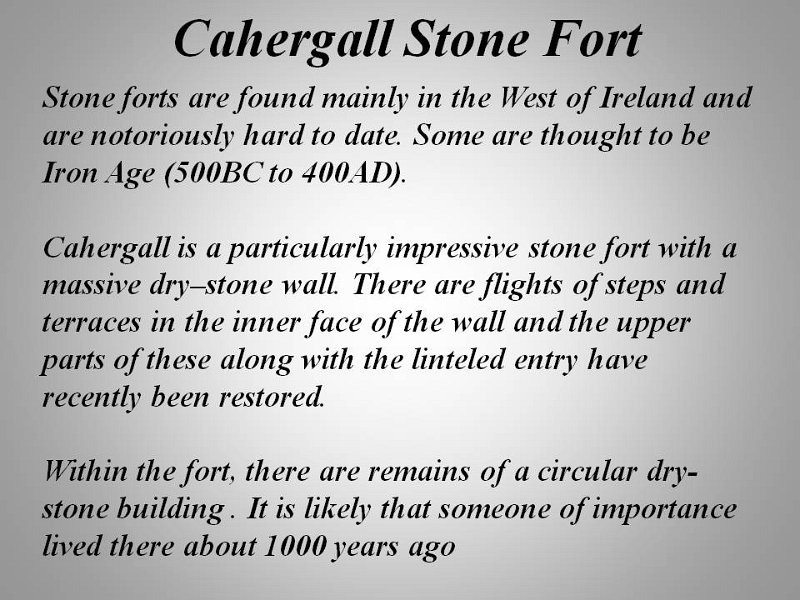
caravan park we were in; the large, round, stone Cahergall
Fort,
with a smaller, round, stone structure inside which may have been some sort of
cairn belonging to an important person; Valentia
Island with Geokaun
Mountain and Fogher
Cliffs views after walking from a car park (which was up a fairly steep
road) - lots of slate lying around and there was a slate mine nearby; through
seaside village of Knightstown.
Then continue on the Skellig Ring (which is an aside ring road to the
Ring of Kerry road). We saw a sign that the road wasn't suitable for buses and
coaches and luckily we were going around anti-clockwise - we went up the steep
side and noticed on the down hill side, that the bends combined with the
steepness, would not have been good for us if we were going the other way. The
landscape was really spectacular,
cliffs and ocean, very much picture postcard stuff, in between the rolling
mist and cloud. We passed through the villages of Waterville, Caherdaniel,
Sneem and Kenmare. We had a long day and were a bit too tired to
travel to a caravan park, so we wild camped in The People's Millenium Forest
about 7ks from Poulgorm Bridge (ROI) for 1 night - it was great, very
dark and quiet and surrounded by moss-covered trees.
13-8-2012
Monday
We drove 75ks south to
Blarney (Republic of Ireland) and Blarney Caravan Park for 2
nights. Stopped in the lovely town of Macroom
on the way for a look around and a little bit of shopping.
14-8-2012 Tuesday
We drove 2 and a half
ks to a car park in the local village of Blarney, and then caught a bus into
Cork. It's only 8ks away but the bus trip took 30 minutes because it went
through all the villages on the way. We wandered around Cork, a fairly big and
nice, clean town. In the building that housed the English
Market we saw many retailers of meat, fish, cheese, fruit and veg, and
the usual trinket shops, with eateries upstairs. After getting the bus back to
Blarney we were close to Blarney
Castle and were going to visit even though we'd seen it and kissed the
Blarney Stone back in 2008 (during our Mediterranean cruise). Unfortunately we
couldn't even see it from the outside or get into the grounds without having to
pay entry, so we went home instead. Because we had been in 2008 we didn't bother
this time. We had already "kissed the Blarney stone" so we discussed
whether we should do it again or not. We weren't sure whether a second kiss
would double our eloquence or remove it entirely, so we decided that we
shouldn't do it again in case it negated our first kiss - we also remembered the
waiting in line and the place seemed pretty busy.
15-8-2012 Wednesday
It was very windy with
heavy rain about 6.30 this morning but it cleared enough for us to move on. We
had heard that there was to be a bad storm and the radio reports later,
confirmed some flooding and trees down but luckily we didn't come across any of
that. We drove 30ks south to Cobh
(pronounced 'cove'), the last port of call for the Titanic before its ill-fated
voyage. It was a tight road into the busy town on the waterfront, with cars
parked all along one side of the road, reducing it down to one lane. Luckily we
were able to go a different way on the way out. We found a park and walked
around the small village but it was so windy with intermittent showers - at
times we felt that we were nearly being knocked off our feet. Walked up the hill
to the big and impressive St
Colman's Cathedral. Then drove a further 103ks north to Cahir
(Republic of Ireland) and The Apple Camping Park for 1 night. It's a
lovely spot, located on a fruit farm - we were given a complimentary bottle of
apple juice on arrival and told we were welcome to walk around the fruit
orchards. It grew fairly windy and rainy again and a couple medium-size branches
broke of the one of the trees right next to us - hopefully none will actually
fall on us.
16-8-2012 Thursday
We drove about 120ks
all up today. First stop was north-west to Tipperary (or Tipp, as it's
known throughout Ireland). Many people will remember the song 'It's a long way
to Tipperary', a well known song written in the early 1900's and heard all over
the world. It was a favoured marching song for Irish regiments in the First
World War. However nothing caught our eye and the town was a busy place, so we
continued on north-east to Cashel. This town became known as the 'City of
Kings' because it was home to the high kings of Munster (one of the Provinces of
Ireland), who ruled for centuries from the magnificent site of the Rock
of Cashel. The Rock of Cashel is the name given to the limestone outcrop
on top of which sits a picturesque complex, including Cormac's Chapel, the most
complete Romanesque church in Ireland, a 13th century Gothic cathedral, a 12th
century round tower and an exquisitely restored 15th century Hall of the Vicars
Choral - most of the complex is in ruins but most of the walls are still intact.
It is here that the original St Patrick's Cross can be seen. The Rock of
Cashel first attained importance as a fortress, with its origins as a centre of
power going back to the 4th or 5th centuries. In 1101, the King of Munster
donated his fortress on the Rock, to the Church. Few remnants of the early
structures survive; the majority of buildings on the current site date from the
12th century.
We walked down the
road to Hore
Abbey (sometimes known as St Mary's), a ruined Cistercian monastery
standing alone in a very large tract of land, and dating from the 13th century.
This structure is mostly ruins with only a few standing walls. The day started
out quite nice but by the middle of the afternoon as we were walking back to the
mhome, the rain started to settle in again. We drove on to Kilkenny
(Republic of Ireland) and Tree Grove Caravan Park for 2 nights.
17-8-2012 Friday
Walked 1.5ks into the
town of Kilkenny and visited Kilkenny
Castle, enormous, impressive and lovely grounds. The original
Anglo-Norman stone castle was built in the first decade of the 13th century. It
was the principle Irish residence of the powerful Butler family for almost 600
years. Over 8 centuries of its existence, many additions and alterations have
made the castle today, a complex structure of various architectural styles.
There were many rooms over 4 levels with gorgeous furniture, paintings and 2
beautiful staircases - one was marble (carpeted) with the handrail being large,
polished, beautifully carved timber, and the other one was based on Moorish
architecture so, the decorative structure above the stairs had a Turkish look
about it. Unfortunately, photos weren't allowed to be taken inside so there
won't be too many of them unless we can find them on the internet. In 1967 the
6th Marquess presented it to the people of Kilkenny for 50 pounds and the
buildings have been in the care of the Office of Public Works since 1969. After
a nice Chinese buffet lunch we made our way home before the rain was due to
start.
18-8-2012
Saturday
Today was a lovely
sunny day and it didn't rain once!! Hallelula! Drove 70ks north to Kildare
(Republic of Ireland) where the Irish
National Stud and Japanese
Gardens are located. This place had been recommended to us and even
though it wasn't the sort of thing we are normally interested in, we decided to
go and see it and were glad we did. It was quite good. The Stud was originally
started back in 1900 by Colonel William Hall-Walker, who purchased a farm at
Tully, Kildare and started to breed thoroughbred horses. In 1915 he gave the
successful Stud as a gift to the British Crown, who in turn bestowed on him the
title of Lord Wavertree. The Stud continued as the British National Stud Company
until in 1943, it was handed over to the Irish Government. In 1945 The Irish
National Stud Company was formed to promote the interests of the Irish
Bloodstock Industry, which it continues to do today. The fees to provide
breeding services ('covering' the mare) depend on the races and money won by the
stallions, as well as the successes of their offspring. Fees range from a few
thousand euros up to €60,000 for the top breeder! Artificial insemination is
not used at this facility. A museum on the property, was opened in 1977, where
you can trace the history of the horse from its evolution to modern times. All
horses apparently evolved from a small animal no bigger than a cat - amazing!
The Japanese Gardens,
on the same site, were also commissioned to be built by Colonel Walker around
1910. The Gardens reflect 'The Life of Man', with individual gardens, bridges, a
tunnel and various pathways, all representing the various stage of man's life -
from birth, growing up learning, marriage, declining years and finally death. It
was quite well done and an interesting concept. We then drove 85ks north-east,
past Dublin, to Rush (Republic of Ireland) and North
Beach Caravan Park for 2 nights. It is right on the beach with some
lovely cliffs in the distance, although not as high or spectacular as the Cliffs
of Moher.
19-8-2012 Sunday
We left early this
morning, about 8.30am, to drive north (all up about 93ks) firstly, to the Newgrange
Visitor Centre at Donore (County Meath), where we were to see Newgrange
and Knowth
(there was a third one, Dowth but we didn't visit it). These are tombs
(one theory) in the shape of large mounds that look from the outside, just like
some rounded hills. In fact, we were told (by the compulsory guide) that, that
was how Newgrange was discovered - it looked just like a huge mound and whilst
workers were quarrying the mound for rocks for construction work, they
discovered something completely different. These structures are about 5000 years
old, 500 years older than Stonehenge, and 1000 years older then the Giza
Pyramids! They have been designated a UNESCO (United Nations Educational,
Scientific, and Cultural Organisation) World Heritage Site. There have been up
to 40 tombs discovered and there are probably more that haven't yet been
discovered. Knowth had about 20 mounds where Newgrange seemed to be just one
large one. Knowth had more of the large kerbstones (127), carved with many, but
repeated, symbols. Newgrange, the best known Irish passage tomb, is surrounded
by a kerb of 97 stones, the most impressive of which is the highly decorated Entrance
Stone. The mound covers a single tomb consisting of a long passage and a
cross-shaped chamber. We went inside the long, narrow, stone-lined passage to
the chamber (which was only capable of holding about 16 people), and the guide
simulated the winter solstice phenomenon - on the shortest day of the year, the
winter solstice, the sun shines through the Roof Box (a boxed space at the top
of the doorway) for 17 minutes, down into the chamber and then is gone (like
Stonehenge). When the guide turned out the normal light (before turning on the
simulated solstice light), we were in total blackness, for a bit too long I
thought, a bit eerie! This whole big mound, about 80 metres across, only housed
this small chamber with 3 very small ones leading off it, and above us, was a
domed ceiling, built of big flat stones. Above that, was tons of dirt and the
chamber remains completely dry.
The location for the
famous battle of The Boyne (Boyne River) was close by, but we were running out
of time so we decided to skip it. After the tours, we drove to Drogheda
9ks away and the Millmount
Complex, comprising a museum and the Millmount Tower. The tower
was constructed during the time of the Napoleonic Wars, was shelled and damaged
during the turbulent Irish Civil Wars. The museum was opened in 1974 and is
located in the officers quarters of the former military complex built in 1714.
It consists of a unique collection of guild and trade banners, an industrial
room (spinning, weaving, brewing, iron works, shoe making), geological
collection (with over 300 specimens of granites and marble from around the
world), curiosities (antique gramophones, typewriters, cinema posters),
authentic folk kitchen (kitchen utensils, earliest washing machines, a variety
of heavy smoothing irons, butter churns), and a small room with a collection of
phones
and phone related items (which is really the main reason for coming here
today). We had a long day and it was getting on for 4.30pm by the time we got
back to the same North Beach Park for a second night.
20-8-2012
Monday
Another lovely sunny
day with only little cloud. Drove 42ks south to Dublin
the capital of the Republic of Ireland, and Camac Valley Caravan Park for
3 nights. We just rested for the rest of the day and Dave organised our ferry
details to Wales in a few days.
21-8-2012 Tuesday
Caught the
Hop-On-Hop-Off bus from the campsite to the city of Dublin (about 12ks) this
morning and did one of the tour routes. We walked to the park to see the very
well-done, multi-coloured marble sculpture of Oscar
Wilde, reclining on a big rock, looking back across the street to where
he'd been born back in 1854. On a couple square short posts nearby, were many of
his famous quotes from his plays. On the bus route today were the impressive Trinity
College (attended by Oscar Wilde), the Molly
Malone Statue
(the lady who sang the cockles and mussels song, alive alive-o), and the Famine
Memorial which was about a half a dozen metal statues of emaciated people
walking along, trying to get away from the devastation of the famine. A big,
stainless steel spire monument that stands 120 metres tall in O'Connell street,
is known as the Tower
of Light, and locally as the Spike, and was commissioned as part of the
Millennium project for Dublin. The black bronze O'Connell
monument still shows bullet holes received during the uprising of the
1916 rebellion, for independence from Great Britain. On the River Liffey
which runs through the middle of the capital, we could see one of the tall ships
that will be part of the Tall Ships Festival in a couple days. We had a nice
meeting and lunch with Roy for the first time today. Roy lives in Dublin and is
a friend of Suzanne's (Joy's cousin).
22-8-2012 Wednesday
Caught Hop-On-Hop-Off
bus again into the city and toured the second tour route around the city. We
visited the the St
James Gate Guinness Brewery which is a very big complex, covering
several blocks. Arthur Guinness started the brewery and One of the tour displays
showed old footage of the very skilled craftsmen, called coopers, making the
wooden beer barrels from scratch. When the new, more effective, steel barrels
came on the scene, a lot of the coopers were no longer needed. Some of them were
kept on for a while, to do any other woodwork needed around the place, as well
as turning the old barrels into many useful things such as tables, chairs,
flower pots, and whatever else could be though up. The tour included us being
shown just how to pour
a pint of Guinness properly out of the bar pull tap (which takes about 2
minutes all up, allowing the settling of the gases that give the creamy texture
to the black drink), then us actually pouring the pint, later getting a
certificate of this proof, and then us being able to drink it - it was great. I
normally don't care for black beer but I made sure I kept in with the spirit of
the tour, and drank it. Some of the barley
is roasted at a high temperature until it turns a golden brown, and this is
what gives Guinness its dark black (although the brewery wording said 'red')
colouring and flavour, and extra hops added to the process, also adds to its
unique flavour. They buy the hops in from all over the world, including
Australia.
We wandered around
another area of the city before catching our bus back. There are about 10
bridges across the Liffey river in the city, no shortage of ways for traffic or
people to cross. We caught a taxi to Roy's place where he cooked us a lovely
dinner and we talked til midnight.
One unusual thing we
noticed on Irish radio was the reading each morning of the latest death and
funeral notices. We don't know if this replaces printing of them in the
newspapers which is the usual thing at home.
23-8-2012 Thursday
We got up early and
left just before 6.30am to make our way to the Dublin Port to catch our 8.20am
ferry across to Holyhead, Wales. We only got about 4 and a half hours sleep so
will have to make up for it tonight. The roads along the river in Dublin, which
is the way to the ferry port, were being closed off from 7am today until the
26th for the Tall Ships Festival. Unfortunately we were missing out on the
festival which was a shame. Fortunately we were able to drive through there
without any diversions as we came through a bit before 7am, so we arrived at the
port in plenty of time. The trip lasted about 3 and a half hours. We did some
grocery shopping when we got to Wales and then drove about 50ks to Brynteg
(Wales) and Penrhos Caravan Club Site for 2 nights.